
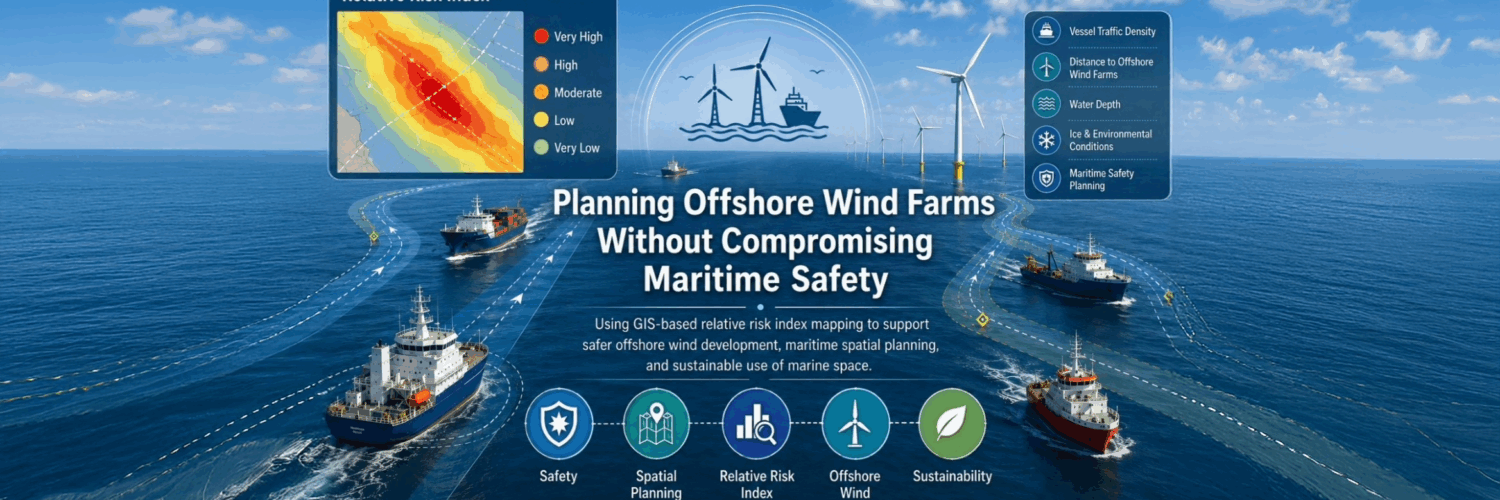
Funded by the Strategic Research Council’s WAWE programme, the multidisciplinary WATERWAYS project examines how Baltic Sea maritime routes can be used safely and sustainably under changing environmental, operational, and infrastructure conditions. The project develops research-based tools for situational awareness, risk assessment and management, and cross-sectoral planning.
In this blog post, our postdoctoral researcher Mojtaba Barzehkar discusses how offshore wind farm development can interact with maritime traffic in the Baltic Sea. The post explains how the assessment of relative spatial risk index patterns can support safer offshore wind farm planning, maritime spatial planning, and more sustainable use of marine space.
Understanding Maritime Space in a Changing Baltic Sea
The Baltic Sea is a busy maritime region. Every day, ships transport goods, connect ports, and support regional economies. At the same time, demand for renewable energy is increasing, and offshore wind farms are becoming an important part of the transition towards cleaner energy systems.
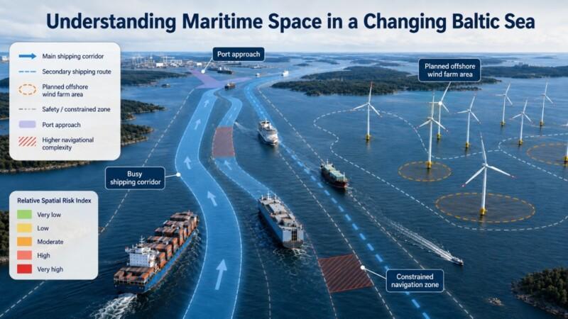
Shipping and offshore wind energy often require space in the same marine areas. At first, maritime routes and offshore wind farms may appear as separate layers on a map. In reality, however, they are part of a complex spatial system. Ships require safe and sufficiently wide navigation corridors, ports depend on reliable access routes, and offshore wind farms need suitable locations with sufficient wind resources, technical feasibility, and acceptable environmental conditions.
Offshore wind farms are generally planned with consideration of existing shipping routes and designated navigation areas. However, their potential influence does not necessarily end at the project boundary. When offshore wind farms are located close to shipping corridors, they may reduce the available manoeuvring space, limit route flexibility, or increase the complexity of navigation. These effects may be particularly important near port approaches, narrow waterways, and areas where maritime traffic is already dense.
This creates several important planning questions:
- Where do planned offshore wind farms interact with busy maritime routes?
- Which shipping corridors may become more spatially constrained?
- Where could offshore wind development increase local navigational risk?
- Which areas require closer coordination among maritime authorities, planners, and offshore wind developers?
Answering these questions requires more than simply displaying wind farm areas and shipping routes on a map. It requires a spatial decision support approach that combines different types of information within an integrated assessment of relative spatial risk index patterns.
Using GIS to Support Risk-Informed Planning
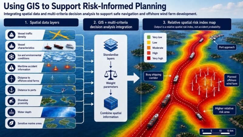
In the WATERWAYS project, we use geographic information systems (GIS) and multi-criteria decision analysis to assess relative spatial risk index patterns associated with interactions between maritime traffic and offshore wind farms in the Northern Baltic Sea. This approach integrates a range of spatial datasets, including:
- vessel traffic density
- vessel characteristics
- environmental and ice conditions
- maritime accident information
- distance to offshore wind farms
- distance to ports
- shoreline proximity
- water depth
- environmentally sensitive marine areas
Each dataset provides only one part of the overall spatial picture. Vessel traffic density shows where ships travel most frequently. Distance to offshore wind farms indicates where spatial interactions may occur. Water depth and shoreline proximity help identify areas where navigation may be more constrained. Maritime accident data provide information about locations where shipping accidents have occurred in the past.
By standardising and combining these spatial layers, we can produce relative risk index maps showing where several risk-related factors occur together. These maps do not estimate accident probability or frequency. Instead, they identify areas where multiple operational, environmental, and infrastructure-related factors may create more constrained navigation conditions.
The maps are not intended to replace expert knowledge or detailed navigational studies. Instead, they make complex spatial relationships more visible, systematic, and easier to discuss among different stakeholders.
Relative risk index maps can support maritime spatial planning by identifying areas where offshore wind development and maritime traffic may require closer attention. For example, they can help planners identify:
- areas where shipping routes pass close to planned offshore wind farms
- locations where manoeuvring space or route flexibility may be limited
- corridors where high traffic density overlaps with spatial constraints
- areas where adequate separation distances or changes to wind farm layouts may be needed
- locations where coordination among stakeholders should begin at an early stage
This is particularly important because offshore wind farm planning involves long-term decisions. Once project boundaries, cable routes, and turbine layouts have been established, making substantial changes can become more difficult and costly. Early-stage relative spatial risk index assessment can therefore help identify and reduce potential conflicts before they become harder to address.
Supporting Safe and Sustainable Offshore Wind Development
Offshore wind energy is essential to the transition towards cleaner energy systems. However, sustainable offshore wind development also requires maritime transport to remain safe and efficient.
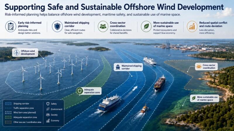
Offshore wind farms planned without sufficient consideration of maritime traffic may create spatial conflicts, increase route deviations, reduce manoeuvring space, or make maritime operations less efficient. Assessing relative spatial risk index patterns at an early stage can help identify these interactions before project boundaries and turbine layouts become fixed.
This may involve adjusting project boundaries, reconsidering turbine layouts, maintaining adequate separation distances, or preserving sufficiently wide navigation corridors. Better spatial planning can also support safer maritime routes, reduce accident and pollution concerns, and improve coordination among maritime authorities, offshore wind developers, planners, and other stakeholders.
The aim of this research within the WATERWAYS project is not to prevent or delay offshore wind development. Instead, it is to support better-informed planning decisions that balance renewable energy development, maritime safety, environmental protection, and more responsible use of marine space.
Mojtaba Barzehkar
Postdoctoral Researcher
Aalto University
Image note: Images in this blog post were generated using artificial intelligence (AI).
References
Ceder, V., Helgesson, N., Thomas, B. P., & Ringsberg, J. W. (2024). The impact of wind farms on winter navigation. Chalmers University of Technology, Department of Mechanics and Maritime Sciences, Division of Marine Technology, Gothenburg, Sweden.
Chen, B. Q., Liu, K., Rong, H., & Ringsberg, J. W. (2026). Ship collision and offshore renewable energy: Challenges and innovations for structural resilience. Renewable and Sustainable Energy Reviews, 226, 116510.
European MSP Platform. (2018). Conflict fiche 7: Maritime transport and offshore wind.
Lang, X., Zhaka, V., Hammarkvist, N., Mao, W., & Ringsberg, J. W. (2026). Potential impacts of wind farms on shipping in the Bay of Bothnia. Lighthouse Reports, Swedish Maritime Competence Centre.
Malczewski, J., & Rinner, C. (2015). Multicriteria Decision Analysis in Geographic Information Science. Springer.
Son, W. J., & Cho, I. S. (2024). Optimal maritime traffic width for passing offshore wind farms based on ship collision probability. Ocean Engineering, 313, 119498.
Zhen, R., Lv, P., Shi, Z., & Chen, G. (2023). A novel fuzzy multi-factor navigational risk assessment method for ship route optimization in coastal offshore wind farm waters. Ocean & Coastal Management, 232, 106428.